Geophysical Logging
IDS is a leading service provider of geophysical logging services in the mining, geotechnical, water infrastructure, and environmental markets. We have combined our vast experience, critical thinking, and the latest technological advancements with standard logging techniques to create downhole geophysics capabilities unmatched in the industry.
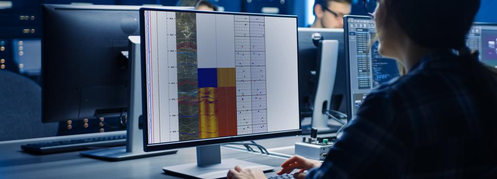
BOREHOLE IMAGING
Optical and Acoustic Televiewer Measurements
- Lithology
- Oriented structural detail, including oriented core reference
- Fracture detection and characterization
- Bedding detection, including dip angle
- Rock competency
- Visual casing inspections
Borehole Video
- Shaft, raise, caisson, etc. inspection
- Pump, water well, and casing inspection
- Stratigraphic feature identification
ELECTRIC AND MAGNETIC MEASUREMENTS
Resistivity, Single Point Resistance, and Spontaneous Potential
- Lithology and facies changes
- Bedding analysis
- Ore body detection
- Aquifer thickness
- Water quality
- Hydrocarbon occurrence detection
- Grain size characterization
Induced Polarization
- Detection of sulfides and ferrous minerals for ore body detection and characterization
Magnetic Susceptibility
- Lithology analysis
- Mineral exploration evaluation studies
- Ore body identification and quality analysis
AUXILIARY MEASUREMENTS
Caliper
- Borehole diameter and volume calculation
- Borehole wall variability, including cavity location
Deviation
- Borehole path XYZ trajectory
- North-seeking non-magnetic gyros for deviation inside steel pipe or casing
- Magnetic deviation including downhole magnetic feature location
NUCLEAR MEASUREMENTS
Compensated Dual Density, Neutron, Natural Gamma
- Lithology changes
- Bedding delineation
- Uranium detection and concentration
- Grain size variation
- Aquifer thickness and clay aquitard detection
- Quantitative In-situ Density
- Petrophysical Properties
- Coal Quality and Delineation
- Density Porosity
- Caliper Borehole Volume
- Aquifer Quality and Delineation
- Moisture Content of Unsaturated Matrix
- Used with other logs, can detect gas zones and identify gas-liquid contacts
FLUID MEASUREMENTS
Borehole Magnetic Resonance, Temperature, Differential Temperature, Fluid Resistivity/Conductivity, Fluid Flow, Water Samples
- Pumping and aquifer flow rate
- Water table characterization
- Porosity, permeability, transmissivity
- Water-well monitoring
- Temperature gradients
- Fluid samples
- Depth-specific water quality and flow differentiation

GEOPHYSICAL DATA INTERPRETATION
- WellCAD analysis software
- Rose plots
- Stereonets
- Fracture tables
- Detailed professional interpretation
